GIS/IT Solutions
The District relies on data to make the most informed decisions and utilizes multiple sources to collect and analyze that data. Proprietary programs on mobile phones, tablets, and weather stations allow our technicians to make on the spot decisions based on real time and historical data. Programs used by the District include FieldSeeker, ArcGIS, and AgNav.
The District is always looking for ways to improve efficiency. One of the ways we have increased our ability to record and analyze data is through improved technology. By utilizing mobile applications, tablets, desktop computers and laptops, we are able to quickly provide answers to residents and municipalities.
Documenting our operations electronically reduced the amount of paperwork, allowing the District to store records more efficiently, for longer periods of time, and in a more secure manner.
FieldSeeker is a program designed specifically for collecting mosquito control data and is built on an ArcGIS platform. The program has two main parts, Core and ULV Office.
The Core program allows us to collect data on our ground operations including site inspections, freshwater larviciding treatments, and catch basin treatments. We are also able to map areas of proposed or new treatments, that will then become part of our historic data base. This allows our field crew to return to these areas in the future to build a treatment history, which can be referred to when selecting wetlands projects. The Mobile application in FieldSeeker allows our crew access to information needed to make informed decisions quickly in the field. Data is transferred between the Core program and the Mobile app in real time, allowing quick response to service requests, as well as access to previous treatments or work done at a particular location.
The ULV Office program allows us to track our adulticiding operations including speed of the vehicle, when the sprayer is on or off, the amount of adulticide applied, wind speed, wind direction, and other variables. The data is collected using tablets connected to our truck sprayer controllers, and then transferred to our desktop application. From there, reports are created including information on the amount of time spent on each service request, total amount of time spent servicing requests, amount of pesticide applied, and equipment used. This is useful when residents contact us to ask if their property had been sprayed, the time the application took place, or why it wasn’t sprayed.
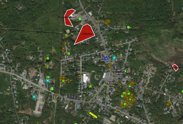
ArcGIS is the basis for all the mapping done by the District. Our base maps provide information on property delineation, ownership, endangered species habitat, and property exclusions, to name a few. Our FieldSeeker and AgNav programs both rely on ArcGIS to display and analyze the data that we collect. Base maps of our District, with appropriate layers added based on our current operations, are created in ArcGIS. This allows us to continue to add additional shapefiles for a complete picture of the activities in our district.
The District uses the AgNav program to capture aerial salt marsh larviciding treatments. It is comprised of onboard hardware that captures the flight path of the helicopter, as well as when the sprayer is turned on or off. This data is then transferred to the desktop app that converts the data to shapefiles that are then uploaded to the ArcGIS basemaps. The spray paths are buffered to capture the true width of the spray swath, which allows us to see where monthly or yearly changes in treatments may have taken place. With this data, our crew can collect and adjust treatment sites as needed.
Applying adulticide requires understanding how weather impacts the pesticide and pesticide placement. The District uses the AirMar WS-200WX weather station to monitor the weather during adulticiding operations. This allows our crew to see what direction the wind is coming from and the speed of the wind, to ensure that they are not allowing the pesticide to drift off target.
The weather stations are mounted to our trucks and send data directly to our FieldSeeker ULV program. The data is uploaded after each application and can be used to answer questions about our operations and whether or not a service request could be fulfilled.
(Sample may not reflect actual work, request, or exclusion locations)